TA extension...Rakuira Great Walk
I have several sections of the Te Araroa Trail on my to do list for the 2019/2020 season. The first I have completed is the extension tramp of the
Rakuira Great Walk Track on Rakuira/Stewart Island. This is not a part of the official TA trail but just a personal section I have added. On this trip I had my partner Karen who often goes out on tramping trips with me.
 |
| Oban is the start and finish point of the Rakuira Track |
This is also my second Great Walk tramp for the summer of 2019/2020. The first was a trip to the Routeburn Track which was rained out by extreme weather on the second day. I knew this trip to Rakuira would be a good one but it went so much better than my expectations.
We had several days of stunningly good weather and one day of rain which only started as we walked off the track. It was the best possible weather conditions for notoriously fickle Stewart Island, we could not have asked for better...
 |
| Rakuira Great Walk, Rakuira: Lee Bay at the start of the track |
|
Neither Karen or myself had ever visited the island and I would thoroughly recommend a trip here if you have any desire to do so. It was fun visiting the island ( in Oban, Ulva Island and the rest) but our main focus was walking the 36 km long
Rakuira Great Walk Track. It is a circular track which can be walked in either direction...we choose to walk Oban - Port William - North Arm - Oban or counter clockwise.
 |
| View along Maori Beach, Rakuira Great Walk, Rakuira |
The track has everything you might want in a good tramp...good but challenging tracks, decent huts, great scenery and plenty of mud. I specifically brought Karen a set of gaiters for Christmas because I have heard many stories about the mud on Rakuira. It wasn't as bad as I expected due to the dry conditions but there was enough...
 |
| Some of that legendary Rakuira mud....Rakuira Great Walk, Rakuira |
We stayed at both Port William and North Arm Huts which were about 80% full with a mixture of Kiwi trampers, locals and Internationals. Both huts were excellent and North Arm Hut became the 200th back-country hut I have visited so adding to the auspicious nature of the tramp.
 |
| At North Arm hut at the end of day two....Rakuira Great Walk, Rakuira |
I really cannot express just how awesome Rakuira is and I am already planing a return for a tramp on either the Northern or Southern Circuit Tracks at the end of this year or early 2021.
Anyway here is how our Te Araroa Trail/Great Walk tramp progressed...
Day One: Oban To Port Wiliam Hut
I have wanted to get down to Stewart Island/Rakuira for decades but never had the time or finances to do so. I decided to just go ahead and plan a trip despite a few logistical problems because if I don't do it now when will I?
 |
| Looking out into Lee Bay at the start of the Rakuira Great Walk |
Karen and I spent five days down in Rakuira including three days walking the Great Walk...we were walking in the usual counter clockwise direction Oban-Port William- North Arm- Oban. The trip started with a taxi ride out to Lee Bay at the start of the track.
Aurora Cab Company cost us $25 dollars and saved a boring five kilometer road walk from Oban so it is well worth spending the money.
 |
| Getting our gear ready at Lee Bay, Rakuira Great Walk, Rakuira |
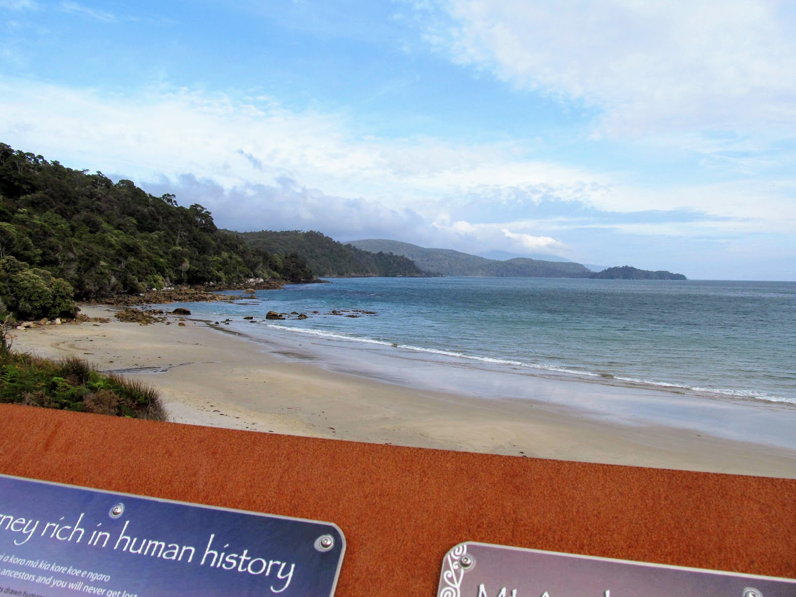
Lee Bay is the start of the track and has a number of information panels as well as toilets and a small campsite if you wanted to stay at the road-head. From the start of the track you can see far to the southwest and in fact you can just make out your destination for the day at Port William in the distance.
The Rakuira Track along this coast reminds me of the Abel Tasman Coastal Walk as it has beaches inter-spaced with headlands you need to climb over.
 |
| DOC information panels at Lee Bay, Rakuira Great Walk, Rakuira |
 |
| DOC information panels at Lee Bay, Rakuira Great Walk, Rakuira |
 |
| DOC information panels at Lee Bay, Rakuira Great Walk, Rakuira |
 |
| Port William is visible as the last headland in the far distance... |
The information panels talk about the track, flora and fauna, Mt Anglem (the highest point on Rakuira) and this is also the place where the old telephone cable came ashore from Mainland New Zealand. It is by far the nicest start to any of the Great Walks I have tramped on...
 |
| Karen gets ready to walk at Lee Bay, Rakuira |
 |
| The old phone line coming ashore at Lee Bay, Rakuira Great Walk, Rakuira |
 |
| DOC track map at the start of the Rakuira Great Walk, Rakuira |
 |
| A saying attributed to a Stewart Islander..... |
The famous chain link sculpture sits right at the start of the track so you pass through it on your way to Port William. The other end of the chain sculpture is at Bluff thirty odd kilometers away across Foveaux Strait and the artifact celebrates the lasting connection of Rakuira to the Mainland of New Zealand.
 |
| The famous road sign at Stirling Point, Bluff...chain sculpture is right next to it.... |
 |
| The Anchor sculpture comes ashore at Lee Bay, Rakuira |
 |
| Detail of the the chain sculpture at Lee Bay, Rakuira |
 |
| Detail of the chain sculpture at Lee Bay, Rakuira Great Walk, Rakuira |
There is a stile at the official start of the track...a fence to keep cattle etc out of the National Park...then it is straight into the tramping. The track quality if very good along this part of the track...dry, benched gravel with bridges over all streams and creeks. It makes for very quick travel for the first couple of kilometers.
 |
| The official start of the Rakuira Great Walk, Rakuira |
Rakuira is covered in mixed podocarp forest and low land forest so the tree types range from massive Totora, Rimu and Matai right down to ferns and other low laying scrub. The forest is rich, verdant and earthy smelling as you would expect from such a wet climate. Because the bush is so thick you only get occasional views along the coast but the positive is that it protects you from the elements which can be savage this far South.
 |
| Large Fuschia Tree on the Rakuira Great Walk, Rakuira |
 |
| Detail of giant fern on the Rakuira Great Walk, Rakuira |
 |
| View along the coastline near Lee Bay, Rakuira Great Walk, Rakuira |
After the first hour you will find yourself at Wooding Bay where there is a track across the first significant water barrier the Little River. There is a high tide track around this bay but we had arrived at low tide so were able to walk across the mud flats to regain the main track.
 |
| First view of the bridge over the Little River, Rakuira Great Walk, Rakuira |
 |
| Little River Bridge, Rakuira Great Walk, Rakuira |
 |
| Jon crossing the mud flats near Little River, Rakuira Great Walk, Rakuira |
 |
| Tidal bay on the Rakuira Great Walk reminiscent of the Abel Tasman |
The track was quiet at this time of the morning it was only as we approached Maori Beach that we saw our first trampers heading out to the road end. We climbed the first of a multitude of steps as we crossed over the next headland to get to the next beach. I hope you like climbing stairs because there are frickin thousands of them to climb over the next three days....I not kidding either!!!
 |
| Mudflats at the Little River, Rakuira Great Walk, Rakuira |
 |
| The Rakuira Great Walk, Rakuira at Little River Bay |
 |
| First of a great many steps on the Rakuira Great Walk, Rakuira |
The climb over Peters Point headland takes about 35 minutes and is through some particularly dense bush. Most of this forest is virgin as it was never logged so you regularly pass trees that might be between 400-800 years old. Some of the land on Rakuira belongs to the local Iwi and you pass through a section of this land as you make your way down to Maori Beach.
 |
| Nice track quality on the way to Maori Bay, Rakuira Great Walk, Rakuira |
 |
| Much of Rakuira is owned by the local Iwi... |
 |
| Karen is looking at some interesting ferns along the Rakuira Great Walk, Rakuira |
Much like the Abel Tasman Coastal Track you get some good views along the coast from the high points of the track. It was a cracker of a day to be walking as it was sunny, about 20 degrees and only a slight wind was blowing.
 |
| View of the beach at Peters Point, Rakuira Great Walk, Rakuira |
 |
| Looking across Wooding Bay to Port William, Rakuira |
 |
| On the Rakuira Great Walk, Rakuira near Peters Point |
 |
| Small stream flows over the Rakuira Great Walk, Rakuira |
Eventually you start to descend down to Maori Beach where there is a campsite with a shelter, water and toilets. There is a low and high tide track...if the tide is in follow the high tide track to avoid wading through the surf.
 |
| Descending down to Maori Bay from Peters Point, Rakuira Great Walk, Rakuira |
 |
| Descending to Maori Bay from Peters Point, Rakuira Great Walk, Rakuira |
 |
| At the Maori Beach high tide track junction |
Maori Beach was the site of a sawmill for most of the early 20th century and there are a number of relics of that era scattered around a clearing in the forest. Follow the short sidetrack to access the clearing, it is at the end of the high tide track backing Maori Beach.
There are several good information panels which give you some idea of what working in this remote spot must have been like....in a word...hard!!!
 |
| The side track to the Maori Beach saw mill site |
 |
| DOC information panel at the Maori Beach Mill, Rakuira |
 |
| Looking at the old mill at the back of Maori Beach, Rakuira |
Once you have finished at the saw mill site follow the high tide track over the bridge to get to the campsite and shelter at
Maori Beach campsite. We stopped here for a 30 minute break...a snack and something to drink as we had been more or less on the go for 1.5 hours to this point. The shelter is very nice and looks to be only a couple of years old...there is a toilet and water tank here so make use of them if required.
 |
| The High Tide bridge to Maori Beach, Rakuira |
 |
| Maori Beach Camp shelter, Maori Beach, Rakuira |
 |
| Shell collection in the Maori Beach camp shelter, Rakuira Great Walk, Rakuira |
 |
| Maori Beach camp shelter, Rakuira Great Walk, Rakuira |
 |
| Rakuira Great Walk, Rakuira: track sign at Maori Beach |
We had a talk to a nice Australian women who was day walking from Port William back to Oban..one of the topics of conversation was the bush fires in Australia as she came from near Sydney. After talking to her for about 15 minutes we packed up our gear and set off along Maori Beach on the last leg of the track to the hut at Port William.
To start with you walk along the beach to a swing bridge over an estuary at the end of the bay..again this reminded me of Abel Tasman.
 |
| Back on the Rakuira Great Walk, Rakuira at Maori Beach |
 |
| View west down Maori Beach, Rakuira Great Walk, Rakuira |
 |
| View of Wooding Bay from Maori Beach, Rakuira Great Walk, Rakuira |
 |
| View east along Maori Beach, Rakuira Great Walk, Rakuira |
Karen wrote her name in the golden sand but look who else was tramping this track....Prince William!!!
 |
| Karen visited Maori Beach...... |
 |
| ...and so did Prince William..... |
You can see the swing-bridge once you get half way down the beach..it is quite a large affair and connects the sand spit with the last ridge you need to climb over before stopping for the day. I'm not quite sure what you do at this beach at high tide...there is no high tide track so I imagine you just walk along the verge of the ocean...
 |
| First view of the Maori Beach swing-bridge.... |
 |
| Rakuira Great Walk, Rakuira: swing-bridge at Maori Beach |
 |
| Last view of Maori Beach, Rakuira Great Walk, Rakuira |
The swing-bridge is about 5 meters above the creek and is the classic wire bridge style with a wooden platform to walk along. I see that DOC Southland have gone crazy with the safety warning signs here as well...the bridge was festooned with images of people falling off the bridge, the wires snapping, boards breaking, alligators eating you etc. etc.
You know...the usual stuff.
 |
| The swing-bridge at Maori Beach, Rakuira Great Walk, Rakuira |
 |
| Karen on the Maori Beach swing bridge |
 |
| Tidal estuary at Maori Beach....much deeper at high tide |
 |
| Tidal estuary empties into Wooding Bay, Rakuira Great Walk, Rakuira |
 |
| Jon on the Maori Beach swing-bridge... |
Once over the bridge it is hump, hump & hump to get to the top of the ridge...you will be climbing a LOT of steps. While this assists with limiting track erosion they are a right pain to walk up as they are high and or long so require some effort.
We just plodded up here taking a break every 20 odd meters as we walked from one anchor point to another. Karen was heard to reflect a bit caustically about "...more bloody steps..." and I was none too happy myself but it is what it is.....
 |
| More steps at Wooding Bay, Rakuira Great Walk, Rakuira |
 |
| Climbing to the ridge between Maori Beach and Port William |
 |
| Rakuira Great Walk, Rakuira....more stairs... |
 |
| Open forest between Maori Beach and Port William |
You are climbing for about 20 minutes and then break out onto a small plateau along the top of the ridge. Midway along this plateau you will come to the side track to North Arm Hut which is where you are headed on day two.
It is 1.9 km's from here to Port William Hut so this is all track you have to cover again tomorrow....but...the hut is only 40-45 minutes walk from here so woo-hoo!!!
 |
| At the Rakuira Great Walk and Port William hut track Junction |
 |
| At the Rakuira Great Walk and Port William hut track Junction |
 |
| At the Rakuira Great Walk and Port William hut track Junction |
 |
| Heading down to Port william, Rakuira Great Walk, Rakuira |
 |
| Rakuira Great Walk, Rakuira....Karen heading down to Port William |
The track descends easily through some very impressive podocarp forest as it winds down to Port William. We passed the hut warden along here as she was doing a bit of track maintenance at the site of a small slip on the track.
The track through here is a bit rough and gives you a good indication of what the second day's travel will be like. There are small slips...there is mud....there is windfall on the track...
 |
| First view of Port William wharf, Rakuira Great Walk, Rakuira |
 |
| Looking out to Port William Bay, Rakuira Great Walk, Rakuira |
 |
| Port William wharf from near the campground |
Eventually we made it down to the coast and the
Port William campsite which is right at the end of the forest track. This campsite also has a nice shelter with toilets but no water tank so you have to go to the hut for your water supplies. From here it is only a couple of minutes walk to the hut...a great sight after walking for a couple of hours...
 |
| Five minutes to Port William Hut, Rakuira Great Walk, Rakuira |
 |
| Nearly at Port William Hut at the end of day one.... |
 |
| Errr....right!!! Helicopter hovering over Port William Hut |
And what did we find when we got to the hut....a helicopter dropping off bags of firewood as an under slung load. It had been a nice days walking from the track end and proved to be the easiest day out of the three days we spent on the track.
At Port William Hut-end of day one
We dropped packs and sat under a tree as we waited for them to depart as you shouldn't be walking around under a helicopter if you can help it. The helicopter was flying back and forth for about an hour after we arrived dropping off what looked like the huts firewood supply for the next two years.
I counted the bags when they finished for the day and there were 23 bags about 1.5 meters by 2 meters...that is a whole passel of wood!!!
 |
| Helicopter flies away after dropping off wood at Port William Hut |
We saw where it had come from on day three of the tramp...a couple of huge trees which had fallen on the track...been cut up and bagged for transport. This is how most DOC huts get their wood..fallen trees as one big Red Beech or Matai tree has enough wood for a years worth of fire.
Some poor bastid has to stack the stuff though.....
 |
| Bagged firewood waits for transportation half way between North Arm and Oban |
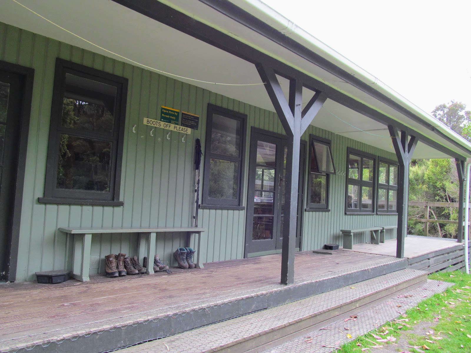
Port William Hut was built in the late 1980's so it is getting along in years now but it was a very nice hut...clean and well maintained. It has 24 bunks with internal water supplied and has a separate attached hut wardens quarters. There are wardens at these Great Walk huts for most of the period from October to April after which they revert to serviced hut status.
 |
| Port William Hut, Rakuira Great Walk, Rakuira |
 |
| The veranda at Port William Hut, Rakuira Great Walk, Rakuira |
 |
| Port William Hut from the bank near the shoreline... |
There is a very nice looking bay right in front of the hut and several people went down for a swim as they walked off the track. It would be damn cold in that water...even though it was sunny we are at the bottom of the South Island...
It would probably have some good fish stocks (Blue Cod, Snapper and shellfish) but you would need to check the status as I think it might be a marine reserve.
 |
| Looking out to Port William Bay, Rakuira Great Walk, Rakuira |
We stayed in the hut for most of the rest of the afternoon with the regular intrusion of the helicopter returning with another load of wood. They only stopped at 3 pm as it had started to rain making it too difficult to fly...
 |
| Helicopter with under-slung firewood at Port William |
 |
| Madness....helicopter hovers over Port William Hut |
The hut has had a recent make over ...the interior is newly clad in varnished plywood with new tables, benches and cooking surfaces. There was a wealth of informative panels about the local area as well as some useful information about hut etiquette and trampers manners.
 |
| Port William Hut: showing the interior of the living area |
 |
| Cooking benches inside Port William Hut, Rakuira Great Walk, Rakuira |
 |
| Port William Hut: wood-burner and clothes rack... |
There are two 12 person bunk rooms with a mix of bunks and sleeping platforms..we were in the bunk-room facing the veranda and beach. As we arrived at about 2 pm we got the good bunks head to head in one corner of the room. By the end of the day the hut was about 80% full so there were only a couple of free spots left.
 |
| Karen's pit set up in the bunk-room at Port William Hut |
It rained quite heavily for about 40 minutes around 3 pm...this was good as there were notices around the water taps about the lack of rain water filling the tanks. Rakuira has had a long dry summer just like the rest of the country and with no alternate water source a full rain tank is vital.
 |
| The bank along the shoreline at Port William Hut |
 |
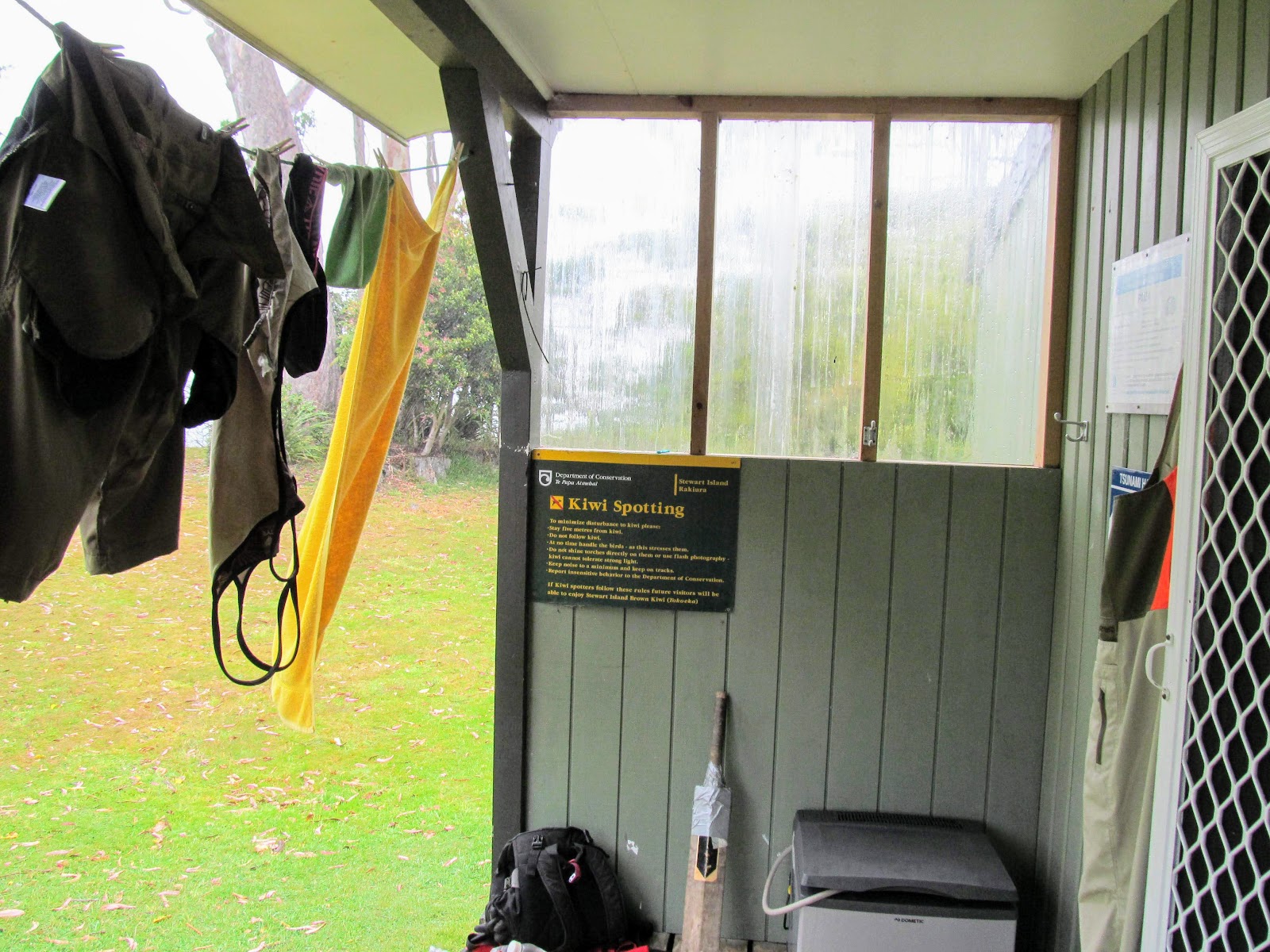
| Instructions about spotting Kiwi at Port William Hut |
 |
| Hut wardens quarters attached to Port William Hut |
 |
| View of Port William with Bobs Point in the distance... |
Later in the evening we went for the obligatory Kiwi search and although Karen and I heard a Kiwi we never saw one. It is really the luck of the draw as the hut warden told our group that two nights earlier a couple of Kiwi were walking around in the clearing the hut sits in.
We did see some of the introduced Whitetail Deer..a doe and a couple of younger deer were walking around eating the grass close to the hut and we could get quite close to them (about 10 meters) before they spooked so we got a good look at them.
 |
| Some of the wild Whitetail Deer near Port William Hut |
 |
| Peters Point from near Port William Hut, Rakuira Great Walk, Rakuira |
So that was the end of the first day on the Rakuira Great Walk...we had walked from Lee Bay to the hut and had covered the first and easiest section of the track. We still had two more days of fine tramping to look forward to as we tramped to North Arm Hut in Patterson Inlet and thence to Oban.
Come back soon and see what day two and three of the tramp were like.....
Access: From Oban take Horseshoe Bay Road and then Lee Bay Road to the start of the track at Lee Bay. There is a taxi service to the track ends, it cost us $25 for two people.
Track Times: 3-3.5 hours from Lee Bay to Port William Hut. If you walk from Oban to the start of the track add an additional 2 hours.
Hut Details: Port William Hut: Great Walk, 24 bunks, tank water, toilets, woodburner with wood supplied: Rakuira Track Biodiversity Hut, DOC Staff hut between Port William and North Arm Huts, no overnight stay, toilet, water tank: North Arm Hut: Great Walk: 24 bunks, tank water, toilets, woodburner with wood supplied. there are campsites at various locations along the track.
Miscellaneous: Great Walk so huts/campsites are on the DOC hut booking system, must be booked for overnight visit. Hut wardens in residence over summer season (October to April).