...heading NOBO from West Sabine Hut to John Tait...
Earlier in the month I was up at Nelson Lakes National Park walking the
Travers-Sabine Circuit. As part of this track I completed another mini section of the TA, the section of track from West Sabine Hut to John Tait Hut.
 |
| Jon on Travers Saddle |
I was travelling NOBO at the time, but hopefully the photos included will give you a bit of an idea of the type of terrain you face while climbing over Travers Saddle (1783 metres) from either side.
West Sabine Hut to Upper Travers Hut via Travers Saddle
I was walking the Travers -Sabine Circuit in an Anti-clockwise direction, this equates as travelling NOBO on this section of the trail.
 |
| The swing bridge to West Sabine Hut over the Sabine River |
 |
| West Sabine Hut, Nelson Lakes NP |
As you can see
West Sabine Hut is an older design but still completely serviceable, it is built in the older style ie all one big room with a central heating point. Given the huge number of people who visit, the hut is in excellent condition.
 |
| West Sabine Hut, Nelson Lakes NP: the bunks |
 |
| Panoramic shot of inside of West Sabine Hut, Nelson Lakes NP |
There is very little bench space in this hut much less than either Lakehead Hut of John Tait which are built to the same design. This was a problem later in the night when lots of people wanted to cook their dinner meal.
The hut was busy....this is a 30 person hut and we only had 3-4 spare bunks by the end of the night...
 |
| West Sabine Hut, Nelson Lakes NP the small cooking bench |
 |
| More bunks in West Sabine Hut, Nelson Lakes NP |
 |
| West Sabine Hut to Upper Travers Hut via Travers Saddle |
The next day dawned overcast but not wet so it was all go for a crossing of Travers Saddle. I knew i had a tough long day ahead of me climbing up and over Travers Saddle so I was out the door of West Sabine Hut and walking by 8.10am.
The first part of the track was easy travel following the Sabine River down to the confluence with the East Sabine. After this it was constant uphill travel for the next 4.5 hours.
 |
| On the track to Travers Saddle from West Sabine Hut |
 |
| Last view of the Sabine River, Travers Saddle Track |
 |
| Map: West Sabine Hut to the East Sabine chasm |
The first climb was only about 150 metres to gain the western side of the East Sabine Valley. Once on the top it was a gentle sidle for the next hour or so along the 850 a.s.l line to the bridge over the East Sabine.
 |
| Start of the climb to Travers Saddle, climbing to the 850 a.s.l line |
 |
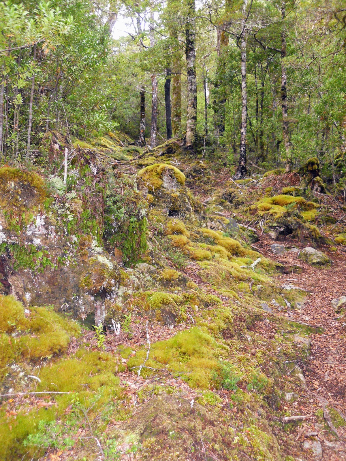
| Travers Saddle Track...there are root ladders |
 |
| Travers Saddle Track....there is moss! |
 |
| Travers Saddle Track...there is open forest sidling |
 |
| Side stream on the Travers Saddle Track, you can drink this water! |
The Sabine River constricts at the chasm to a gap of about three meters so it has gradually eaten its way down into the underlying rock. From the bridge the river would be about 40 meters below the level or the surrounding land.
 |
| The bridge over the East Sabine Chasm, Travers Saddle Track |
 |
| View down into the East Sabine Chasm, Travers Saddle Track |
 |
| View down into the East Sabine Chasm, Travers Saddle Track |
 |
| The East Sabine River from the Travers Saddle Track |
About 10 minutes from the East Sabine bridge are a couple of side streams, these are the last water resupply points until you reach the other side of Travers Saddle so fill up here. You have a long hot climb ahead of you.
 |
| Side stream on the Travers Saddle Track...this is the last water resupply point for 3 hours! |
The next section of track is up an unnamed stream bed for about 300 metres, after this you sidle off to the right to a new track up a spur. This track is not shown on the topo maps as it is only a year old. Its not a bad track but it is a constant uphill slog for at least 2-3 hours.
It gradually gets steeper as it climbs to the bush line.
 |
| Starting the climb to Travers Saddle in a creek bed, Travers Saddle Track |
 |
| Map: East Travers bridge to Travers Saddle...the new track shown in red! |
 |
| Heading up through the beech forest, Travers Saddle Track |
I accidentally snapped my trekking pole the previous day so I had to make an expedient one from a branch I found next to the track. Model I lasted all the way from Sabine Hut to the bridge literally 50 metres from Upper Travers Hut where it too snapped.
What a bloody legend it was...I carefully placed it back on the forest floor with a heartfelt thanks to the forest.
 |
| Poles, trekking, wooden, expedient, Mark I |
 |
| Thinning forest half way to Travers Saddle |
The first view of the way I had come was about an hour into the climb up the spur, you can see the Mahanga Range on the other side of the valley but little else.
 |
| First view of the surrounding mountains on the Travers Saddle Track |
 |
| Miniature beech trees...Travers Saddle Track |
 |
| More open forest near the bushline, Travers Saddle Track |
I spotted another pair of broken walking poles near here so it is obviously a common occurrence on this track.
 |
| East Sabine Valley from the Travers Saddle Track |
 |
| Looking towards the Mt Franklin from Travers Saddle Track |
 |
| About to exit the bushline after 2 hours climbing, Travers Saddle Track |
 |
| The bushline at 1500 metres, on the Travers Saddle Track |
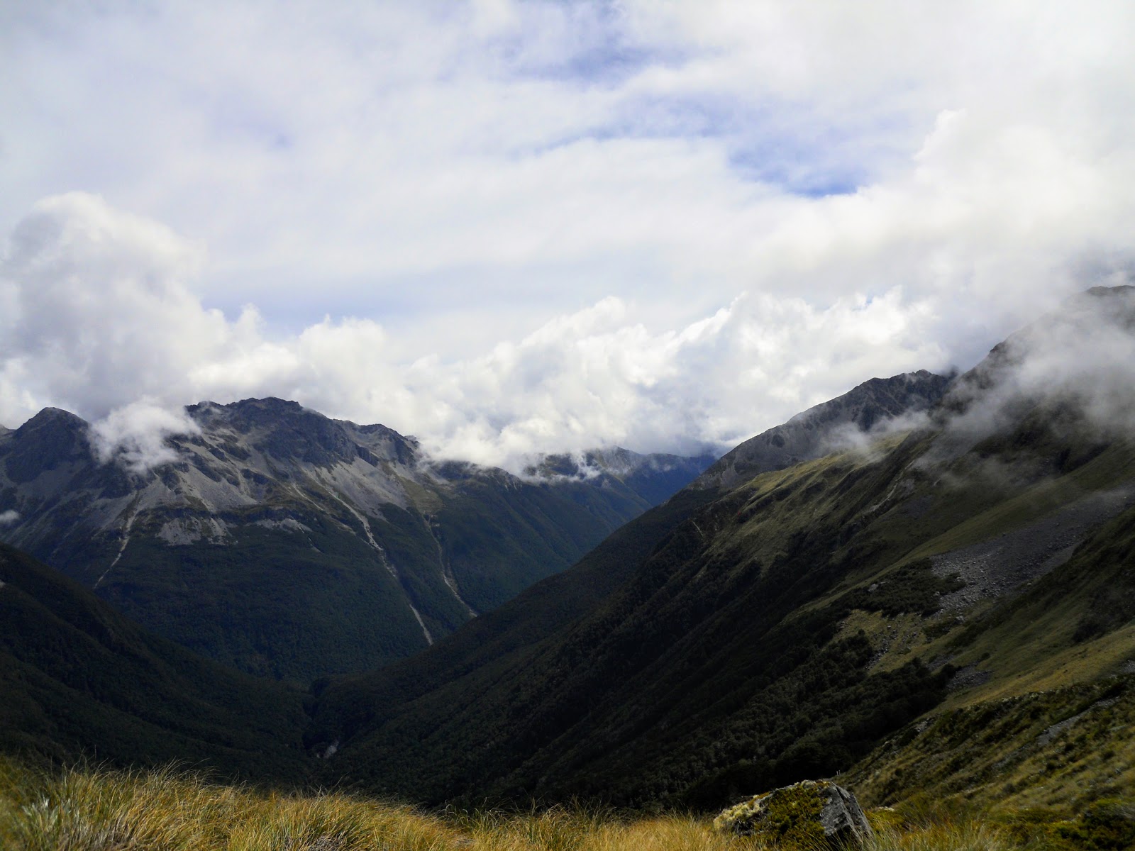
Once out of the bush the view was much better, you can see al the way down to the Sabine River as well as the peaks which surround you on all sides. In the photo below you climb over the slip at the end of the East Sabine Valley and sidle along the far side of the valley for an hour. Then it is climb, climb, climb!!!
 |
| View down into the East Sabine Valley, Travers Saddle Track |
 |
| Cloud forming over the distant Mahanga Range, near Travers Saddle |
 |
| A native Common Speargrass along the Travers Saddle Track |
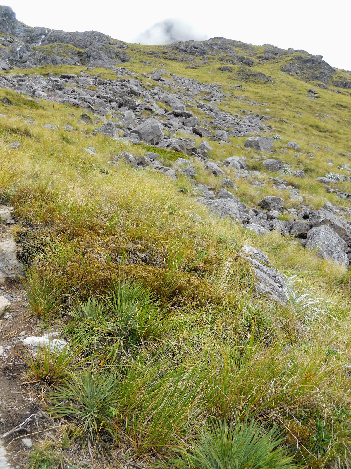
It takes about 45 minutes to climb from the bush-line to the saddle itself...it is steep and rocky going so a slow pace is required for safety. It is a mixture of tussock, rocks and shingle slides...the path is fairly obvious and it is also marked with snow poles.
 |
| Cloud rolls over the Travers Saddle Track from just short of the saddle |
Take care here if it is cloudy...the cloud came down when I was half way to the saddle and I literally could not see 3 metres. There are a lot of fall hazards in the area so make sure of your footing.
 |
| In the tussock just short of Travers Saddle, more speargrass |
There are lots of false crests if you walk up from East Sabine Valley...you have been warned!
 |
| Mt Travers from the last climb before Travers Saddle |
I finally made it to the top of Travers Saddle after about 5 hours of tramping..it was slow going climbing up that long spur line. I stopped for about 10 minutes on top for a snack and some water and then continued walking.
On a lovely sunny day I bet the saddle is spectacular, but on the cold, windy, cloudy day I had the saddle had a very foreboding feel to it. I didn't like being up there by myself at all, the first time I have ever felt like that tramping.
Spooky as hell!
I think it was because I was thinking about the German tramper
Christian Prehn who vanished without a trace up there in 2014...I can totally see how you could walk in the wrong place and disappear never to be seen again.
I got going as soon as possible.....
 |
| Atop Travers Saddle with Mt Travers in the background |
 |
| Jon on the top of Travers Saddle |
Once I got to the saddle I thought it would be relatively easy to make my way down to the hut....I should have known better. It is steep, rocky and very broken terrain up here. It took me over 1 hour and 45 minutes to get down to the Upper Travers Hut.
It was really slow, tough going....
 |
| Travers Saddle Track descending into Travers Valley |
 |
| Mt Travers from the Travers Saddle Track |
If you are desperate for water you could take some from the tarn pictured below but for gods sake filter it as it will be used by Red Deer and Chamois. Otherwise there is a small stream about 10 minutes further down the track which I used.
 |
| A alpine tarn on the descent to Travers Valley, Travers Saddle Track |
 |
| Large historic rock slide on the flank of Mt Travers |
 |
| Pt. 2096 from the Travers Saddle Track |
 |
| Map: Travers Saddle to Upper Travers Hut |
 |
| Large moss growing next to the Travers Saddle Track |
There is a bit of precarious rock hopping involved in crossing the edge of the rock fall zone on the flank of Mt Travers.
 |
| Crossing the Mt Travers rock slide area, Travers Saddle Track |
 |
| View down into the Upper Travers cirque, St Arnaud Range in distance |
The last drop down to the Travers Valley floor is steep so take your time on the descent. The track helpfully zig zags down this slope but the track marking leaves a bit to be desired...
 |
| Route down to the valley floor in the Upper Travers Valley |
 |
| Flowering Common Speargrass in the Upper Travers Valley |
 |
| Hey SOBO's...the track to Travers Saddle is up this slope.... |
 |
| Upper Travers Valley, from the Travers Saddle Track |
Once you make it down to the Valley floor the travel is a little easier although you are still about 30 minutes away from the hut. Watch the holes...the tussock covers up a multitude of ankle breaking holes through here.
 |
| Travers Saddle as viewed from the Upper Travers Valley |
Upper Travers Hut is located in the first finger of bush you can see as you make your way down the Valley. It is a beautiful location with the surrounding mountains and alpine meadows around it.
 |
| Travers Saddle Track descending to Upper Travers Hut |
 |
| View of the Upper Travers Valey from the track to Travers Saddle |
 |
| Footbridge over the Upper Travers River, Travers Saddle Track |
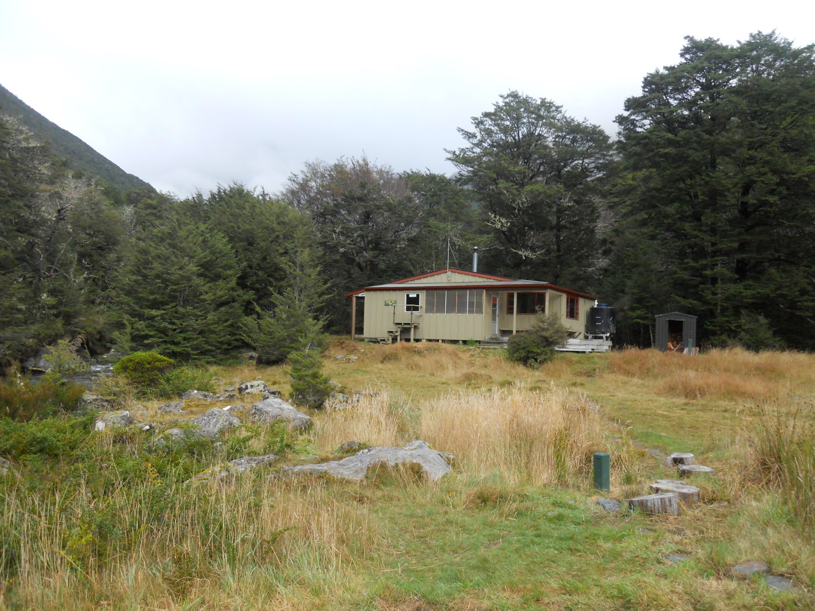
I was very pleased to see Upper Travers Hut...I left West Sabine Hut at 8.10am that morning and arrived at Upper Travers at 3.30pm. That is over 7.5 hours of walking and I was looking forward to putting my feet up.
 |
| Upper Travers Hut, Nelson Lakes NP |
There were only five people in the hut when I got there but as the afternoon wore on more and more people joined us. Mostly it was TA walkers, some NOBO but most of them heading south. A fine evening was spent with the fire going as I had cut up a goodly pile of firewood in the afternoon.
Upper Travers Hut to John Tait Hut
Upper Travers Hut is very nice...it is one of the newer huts on the Travers Sabine Circuit and remained warm even when it was cold outside. It is certainly a step up from West Sabine and John Tait Huts that is for sure.
Plenty of space as well, the hut was quite busy with trampers but even though we had over 20 people in the hut it didn't seem to be that full.
 |
| Upper Travers Hut, Nelson Lakes NP: the cooking benches |
 |
| The two bunk-rooms in Upper Travers Hut, Nelson Lakes NP |
 |
| My pile of wood splits, Upper Travers Hut, Nelson Lakes NP |
 |
| DOC sign, Upper Travers Hut, Nelson Lakes NP |
 |
| View of Mt Travers from inside Upper Travers Hut, Nelson Lakes NP |
Below is the only clear view I had of Mt Travers in the nearly 18 hours I spent at Upper Travers Hut. The top third of the mountain was constantly covered in misty cloud for all of the rest of the time, Mt Travers is obviously on the inversion line for cloud formation.
I wouldn't want to be in this hut in a big earthquake, there is a LOT of loose 'weetbix' rock up there.....
 |
| Mt Travers from Upper Travers Hut, Nelson Lakes NP |
 |
| Upper Travers Hut to John Tait Hut |
Everyone was gone from the hut by 8am, I was the last to leave with two other people heading down valley while the rest headed off to climb over Travers Saddle.
It was a short day for me, only 9 kms or three hours from the Upper Travers Valley to John Tait Hut. I took my time after the exertions of the previous day.
 |
| Starting out on the Upper Travers Track, from near Upper Travers Hut |
 |
| Last view of Upper Travers Hut, Upper Travers Track |
 |
| Upper Travers River, Upper Travers Track |
 |
| Pole beech in the Upper Travers Valley |
 |
| Upper Travers Valley one hour from the hut |
There are three bridges to cross as the track meanders from side to side of the Valley in an attempt to avoid avalanche chutes. It is fairly pleasant walking, the track is well marked with plenty of obvious trail sign and there are bridges over all the major side-streams.
 |
| Bridge number one, Upper Travers Track |
 |
| Goblin forest on the Upper Travers Track |
 |
| Mt Hopeless Massif from the Upper Travers Track |
There are a couple of possible camp sites down in the valley, there are a series of river flats about half way between the huts with easy access to the river. I saw a threesome of happy looking hikers at breakfast at one of these spots.
 |
| Possible camp-site in the Upper Travers Valley |
 |
| Bridge number two, Upper Travers Track |
 |
Back into the beech forest, Upper Travers Track |
If you like waterfalls make sure you take the short 10 minute sidetrack to Travers Falls, they are not that high but have a goodly amount of water going over them.
 |
| Turn off to Travers Falls, Upper Travers Track |
 |
| The open beech forest around Travers Falls |
 |
| A mire or alpine bog, Upper Travers Track |
 |
| River flat travel on the approach to John Tait Hut, Upper Travers Track |
John Tait Hut is about 2.5-3.5 hours down the valley from Upper Travers Hut. It is one of the older huts on this track but still a great spot to stop. It was occupied by two dope smoking totally non communicative Frenchmen when I arrived but they soon packed up and headed for the Upper Travers Valley.
 |
| Avalanche advisory for John Tait Hut, 50 metres to go..... |
 |
| Finally arrive at John Tait Hut, Upper Travers Track |
So, I finally arrived at John Tait Hut after about 3 hours of walking.
Just a point of interest, if you are walking the Te Araroa in the 2018/2019 season you will no longer be able to stay at John Tait Hut. The hut is due to be removed some time this year as it sits about 20 metres away from an avalanche chute and is regularly hit by avalanche debris during the winter.
 |
| Avalanche debris field right next to John Tait Hut in 2017 |
 |
| John Tait Hut from the far side of the clearing it occupies |
A new hut is due to be built somewhere between the Travers River swing-bridge and John Tait Hut, the exact location is still not decided...
Access: SOBO from St Arnaud via Lakehead Track and Travers Valley Track. NOBO from West Sabine Hut follow the Travers Saddle Track.
Track Times: 10.5 km's or 6-9 hours West Sabine to Upper Travers Hut, 9 km's or 2.5-3 hours Upper Travers to John Tait Hut
Hut Details: West Sabine Hut: serviced, 30 bunks, wood burner, water tank, wood
shed, toilets; Upper Travers Hut: 24 bunks, wood burner, water
tank, wood shed, toilets; John Tait Hut: serviced, 27 bunks, wood burner, wood shed, toilets, water tank
Miscellaneous:The track over Travers Saddle is classed as a route only but is marked with snow-poles the whole way. High alpine pass, watch weather in region, some fall and rock fall hazards. Avalanche zone from May-November.