...Havelock to Pelorus Bridge on the Te Araroa Trail...
I recently had the opportunity to walk the Havelock to Pelorus Bridge section of the Te Araroa Trail. This is the first TA section I have managed in more than a year and is one of the linkages between the Queen Charlotte Track and the Richmond Ranges.
 |
| On SH6 just outside Havelock enroute to Pelorus Bridge |
Most of this section is either road walking or following farm tracks between the two points although the last kilometer or so is through some very nice forest.
 |
| Map: Te Araroa Trail- Havelock to Daltons Bridge |
From Havelock you walk along State Highway 6 (SH6) for about two kilometers where you take Te Hoiere Road to a bridge over the Pelorus River. Along the way you pass the estuary for Pelorus Sound which surrounds the small town of Havelock.
 |
| Pelorus Sound from just SH6 outside of Havelock |
 |
| Turn off to Te Hoiere Road from SH6 |
Prior to this year you had to road walk all the way to Daltons Bridge just past Canvastown but this section is now away from the busy Highway and along a quiet rural road. It is a much better option....
 |
| Te Hoiere Road, Te Araroa Trail |
At the end of the road you turn left along Kaiuma Bay Road and walk for about 12 kilometers along this rural road. This is typical TA road walking...you just put your head dawn and move your feet.
 |
| We follow the TA sign left along Kaiuma Bay Road |
 |
| One of several small bridges along Kaiumu Bay Road |
When you get to the turn off for Daltons Road you cross a stile and follow a grassy pathway along the side of the Pelorus River for about four kilometers across farmland. This is a specific TA easement so stay on the path and do not jeopardize access to this section of the trail...follow the poles with the orange triangles/bands as this is the track.
 |
| Joining on to Daltons Bridge Track, Te Araroa Trail |
 |
| Map: Te Araroa Trail- Daltons Bridge to Pelorus Bridge |
The track is fairly obvious as it gets a lot of use and while there are some boggy patches close to the start it is a fairly decent track for the rest of its length.
 |
| You walk for six kilometers along the Pelorus River bank |
 |
| On the TA between Daltons Bridge and Pelorus Bridge |
Eventually you will find your self at the end of the farmland and the start of the Pelorus Bridge Scenic Reserve. There is another stile here that will take you into some nice Beech forest for the last kilometer or so of your walk.
 |
| Crossing into Pelorus Bridge Scenic Reserve, Te Araroa Trail |
 |
|
| View back down the Pelorus River Valley, Te Araroa Trail |
|
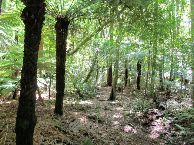
Pelorus Bridge Scenic Reserve is sandwiched between Richmond Forest Park and the road walk from the QCT. It is a taste of what awaits you over the next couple of weeks in the Richmond Range and Nelson Lakes NP. You will be walking through Beech forest from here to the river valey after Waiau Pass.
 |
| First trail marker...Pelorus Bridge Scenic Reserve |
 |
| Heading further into Pelorus Bridge Scenic Reserve |
The TA route follows the Circle Loop Track from here to the Pelorus River bridge...there are two tracks which make up this walk. You can follow either path as both lead back to SH6. I followed the right hand or up hill route as I know this quickly levels out into a nice flat forest walk to the Rai River bridge.
 |
| On the Circle Loop Track, Pelorus Bridge Scenic Reserve |
 |
| Following the right branch of the Circle Loop Track... |
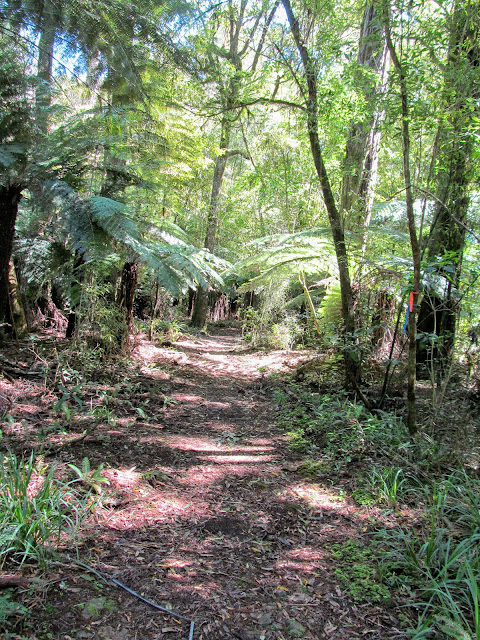
There are a mixture of different Beech species in this forest with the largest being Red Beech. One of the Red Beech had fallen over a couple of hundred meters up the track and you could see just how big these trees are. The amount of detritus on the forest floor from the one tree was enormous..
 |
| Fallen tree along the Circle Loop Track...Pelorus Bridge Scenic Reserve |
 |
| ...there is a lot of timber there... |
The track meanders through the forest for about 600 meters...it is rough and ill defined but just follow the orange track markers and you will not get lost...
 |
| On the Circle Loop Track heading for Pelorus Bridge |
There is an active pest trapping program at work in this reserve and you could see trapline marking and traps right along the course of the walk. Traps are denoted by either coloured tape of triangles and if you see tape tied to a tree there will be a trap close by.
 |
| Trapping line marking on the Circle Loop Track |
 |
| ...the tape denotes a trapline... |
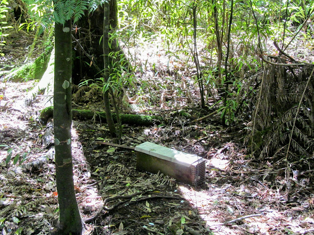 |
| ...here is the trap at the end of the trapline marking... |
 |
| Mature Red Beech along the Circle Loop Track |
You will eventually reach a set of stairs that lead down to the approaches to the suspension bridge over the Rai River.
 |
| Stairs led to the Te Araroa Trail....and Daltons Bridge |
 |
| Suspension Bridge over Rai River...Te Araroa Trail |
The Rai River is a moderately sized waterway that feeds into the Pelorus River just down from the Pelorus River Bridge. It was high on the day I visited as it had been raining for the proceeding couple of days...
 |
| Rai River suspension bridge...Pelorus Bridge Scenic Reserve |
 |
| Rai River from the suspension bridge...Pelorus Bridge Scenic Reserve |
After the Rai River there is just 300 meters till you reach SH6 once again and the end of your days walk. There are glimpses of the Pelorus River as you walk and a nearby lookout point gives good views down to the river itself.
 |
| On the Circle Loop Track, Pelorus Bridge Scenic Reserve |
 |
| Pelorus River from a lookout on the Circle Loop Track |
Just past the lookout you get your first view of the Pelorus River Bridge...you are close to the road and the noise of traffic using this main highway grows louder and louder. When you start out the next day you will be walking up Maungatapu Road which is directly opposite the Circle Loop Track entrance...
 |
| First view of the Pelorus River Bridge.... |
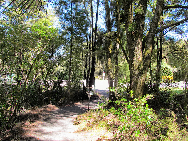 |
| Back at SH6 at Pelorus Bridge, Pelorus Bridge Scenic Reserve |
 |
| The end of the Havelock to Pelorus section... |
The Pelorus Bridge was built way back in the 1930's and has been in constant use ever since. There have been several plans to replace it with a two lane structure as it is on the main highway from Nelson to Blenheim but you are looking at several billions of dollars and an awful lot of hassle. It keeps getting put in the 'too hard' basket...
 |
| Pelorus Bridge, Pelorus Bridge Scenic Reserve |
 |
| The Kahikatea campsite is on the opposite side of the river... |
If you are staying at Pelorus Bridge for the night and it is warm then go for a swim in the river. I have been in here several times over the years and it is awesome in the middle of summer. Obviously it is hideously cold over winter and dangerous in flood so consider that before jumping in...use some common sense.
Please do not jump off the bridge...several people have died that way.
 |
| Downstream view of the Pelorus River, Pelorus Bridge Scenic Reserve |
The main DOC office and a café are on the opposite side of the fbridge so you will need to head over to get yourself a campsite for the night. Be aware that this is a favoured Kiwi Christmas and New Year holiday spot so it pays to pre book if you possibly can.
The café does an nice cup of lifers juice...
 |
| Entrance to the café and DOC office at Pelorus Bridge Scenic Reserve |
 |
| Kahikatea Campsite at the Pelorus Bridge Scenic Reserve |
So another short section of the Te Araroa Trail completed...I have the other connector from Anakiwa to Havelock on my to do list for this year. Hopefully I get a chance to show you the new tracks they have built for TA walkers on that route very soon....
Access: SOBO from Havelock via SH6 road, Te Hioere Road, Kaiamu Bay Road and Daltons Track to Pelorus Bridge. NOBO from Pelorus Bridge follow Daltons Track, Kaiamu Road, Te Hioere Road and SH6 to Havelock.
Track Times: 20.7 km's or 5-6 hours
Hut Details: No huts on this section of the TA. DOC campsite at Pelorus Bridge.
Miscellaneous: The first section is road walking along a busy highway for two kilometers. The remainder is either rural road or across farmland. Please keep to the marked track at all times.


